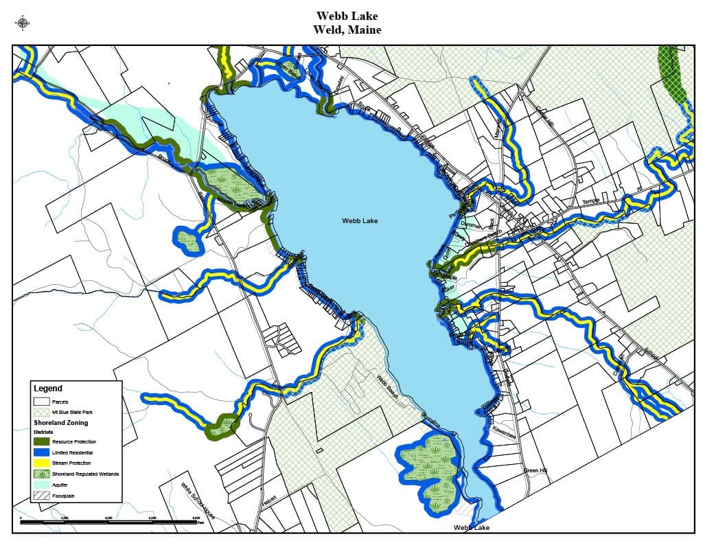
📍 What the Shoreland Zoning Map Is
In Weld, the official shoreland zoning map is a component of the town’s Shoreland Zoning Ordinance. It graphically shows how areas near water bodies are classified under different shoreland zoning districts. This map is legally part of the ordinance and is used to determine what zoning rules apply to land near lakes, rivers, streams, and wetlands.
📏 How It Works
- The map covers shoreland zones, which in Maine generally include land within 250 feet of normal high-water lines of lakes, rivers, and freshwater wetlands, and within 250 feet of streams that flow to those waters.
- District boundaries on the map are drawn at a scale of at least 1 inch = 2000 feet, and shown with a legend that indicates the various zoning categories (for example: Resource Protection, Limited Residential, and Stream Protection).
- The map must be certified with signatures (by the Weld Planning Board chair and the municipal clerk) and kept on file at the Town Office.
🗺️ Zoning Districts Shown
The official shoreland zoning map divides shoreland areas into districts such as:
- Resource Protection (RP) — typically the most restrictive district to protect sensitive natural resources
- Limited Residential (LR) — generally allows residential and recreational development with certain standards
- Stream Protection (SP) — applied along smaller tributaries and streams with specific protections
Because the map is part of the ordinance, it’s used together with the text of the Shoreland Zoning Ordinance to determine which land use activities are allowed, which require permits, and how structures and land alterations must be sited.
📌 Why It Matters
The shoreland zoning map helps:
- Protect water quality and wildlife habitat
- Regulate building and land disturbance near water
- Guide permit decisions and land use planning
- Ensure compliance with Maine’s Mandatory Shoreland Zoning Act